GeoSection Land Desktop 5.0
- Categoría: Graphic Editors
- Licencia: Shareware
- Tamaño: 137.86 KB
- Sistema: w2000 wXP Vista w7
- Idiomas:

Plugin for Autodesk Land Desktop which adds new functions.
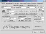
Autodesk Land Desktop is one of the most comprehensive professional tools to define and edit alignments of land and roads. You now have this GeoSection Land Desktop, a plugin that adds new functions and features aimed at topographic readings.
With GeoSection Land Desktop you can perform survey field readings, adjust them; contour drawing and digital models directly on the ground; generate tables of polygonal construction; insert curves, corners, longitudinal profiles, cross sections; find volume calculations; perform treatments on coordinate systems; run coordinate conversion tools, etc.
In addition, to document each subdivision project, GeoSection Land Desktop lets you insert annotations and descriptive reports. It also has tools to anticipate potential earthworks, establish hierarchies of all the processes involved, create cross sections, and so on.
DownloadGeoSection Land Desktop 5.0 related downloads


ACDSee Photo Manager 18
 Download
International versions of this excellent image administrator and viewer, with many supplementary functions.